Whilst on my recent hike to Carnedd Llewelyn I saw across the valley a mountain that had an intriguing pyramid shape. Looking on my map I discovered that it is called Elidir Fawr. Due to its interesting geometry I decided that it would be my next objective. So I returned to Snowdonia for some more hiking.

just right of centre
The route from Llyn Ogwen goes up Y Garn (947 m) then drops down to about 800 m as it passes below below the summit of Foel Goch before finally heading up to the peak of Elidir Fawr (924 m).
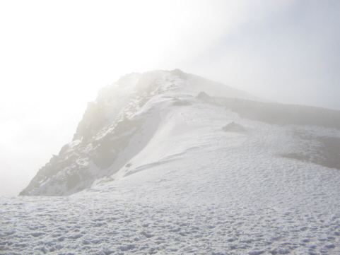
From Llyn Ogwen there a short gentle introduction to the walk of about 500 m as you pass Llyn Idwal. From here you can see the scramble up Devil’s Kitchen. The path up to Y Garn is fairly steep as it leads you up past Pinnacle Crag. A short, flat ridge enables you to catch your breath before the path ascends up a relatively shallow scree slope. There was compact icy snow along this part of the path, but just to the side of the path the snow had melted leaving muddy, slippery scree. Some clouds had closed in by this time, reducing visibility. Ahead of me the snow covering a larger area of the ground and there was no avoiding it. From the valley there did not seem to be much snow and I began wonder whether I would be able to continue much further across the icy snow when the path suddenly flattened out. It turned out that the summit of Y Garn was only about another 100 m away.

From Y Garn the path drops about 150 m before heading over a broad ridge towards Elidir Fawr. There are points where the path is quite close to the craggy north edge, offering views across to Pen Yr Ole Wen and Llyn Ogwen. By this time the cloud had dispersed and I was able to enjoy looking across at the other mountains.

The path continues by Foel Goch, which I decided could wait until I was on the way back, time permitting. Apparently it can become quite boggy along this section of the trail. Due to the cold, dry weather the ground was firm under foot today.
As the path approaches Mynydd Perfedd it curves around to face the pyramid edge of Elidir Fawr. The path starts to rise and you are suddenly rewarded with a view of Marchlyn Mawr Reservoir, which was a gorgeous shade of deep blue now that the sun had come out. From here it a short, steady climb up to the long, rocky summit of Elidir Fawr. The summit was peaceful with good views in most directions, although it was very hazy in the direction of Snowdon.

Since I was in plenty of time I bagged the peaks of Mynydd Perfedd and Foel Goch as I headed back towards Y Garn. The top section of the path back down from Y Garn was quite slippery, my trekking poles did a great job helping me to keep my balance. Below the scree there is a rock footpath most of the way back to Llyn Ogwen.
This turned out to be a pleasant hike with plenty of good views of the mountains of Snowdonia.
http://www.shareyouradventure.com/map/perma/11064/iframe
My walking route shown on Share Your Adventure.
More photos from this hike can be found in the Elidir Fawr via Y Garn set on Flickr.